Chemical Lane, Staten Island


January 31, 2012 -

The Arthur Kill - a tidal strait dividing Staten Island and New Jersey - is one of the most abused waterways in New York City. Its salt water marshes and fresh water wetlands have been used for over a century as an enormous dumping ground, and it has been poisoned by raw sewage and oil spills. After decades of heavy use, its shoreline in western Staten Island is now a series of post-industrial wastelands. Traveling south down the Arthur Kill, these include the demapped streets of Bloomfield's oil tanker fields, the unnatural hills of the Fresh Kills Landfill, the moldering wrecks of the Rossville boat graveyard, and the abandoned LNG gas tanks at Chemical Lane. All of these wastelands face New Jersey's infamous Chemical Coast, located just across the Kill.


Today, the New York City Economic Development Corporation (NYEDC) is planning to redevelop a section of Staten Island's polluted, abandoned coastline. It is offering up "the largest New York City-owned property available for maritime development," according to the Staten Island Advance, with "2,000 linear feet of shoreline along the Arthur Kill." This 33-acre lot is located at the foot of Chemical Lane, a desolate half-paved road that dead-ends in the Kill. The property is an overgrown wilderness, with dirt paths leading to several collapsing piers, and is part of a much larger abandoned industrial complex which includes the LNG gas tanks, a neighborhood landmark still considered to be "Staten Island’s most complex and ambitious project," according to the Staten Island Advance. These tanks have sat empty for over 30 years while nature has reclaimed the area, and in many ways, the clash between haphazard development and encroaching wilderness on Chemical Lane illustrates the troubled relationship that Staten Island has with the Arthur Kill.

Chemical Lane Paved


Chemical Lane Unpaved

The neighborhood around Chemical Lane was once a rural wilderness. "Twenty years ago, it was like upstate around here,” one neighborhood resident told the NY Times. “It was all woods. The old guys tell me they used to walk down the road with a gun and hunt." Today, much of that wilderness has been paved over by development or put to unnatural use. Chemical Lane currently houses a random assortment of businesses that are bluntly at odds with nature, including a golf range where you can tee off into the Arthur Kill, a topsoil company piled onto a muddy open plain, and a paintball field set up in a plastic-coated forest. Bordering these businesses are a prison which was built in 1976 and closed down this year, and a maritime scrapyard.

Chemical Lane's most visible structures, its towering gas tanks, were completed in 1975. "The 10-story tanks, which are 250 feet in diameter, have steel roofs and concrete walls 10 feet thick," according to the NY Daily News, and "were built to store liquefied natural gas safely, even if they were struck by a 747." Upon completion, they were "heralded as the world’s largest" liquefied natural gas (LNG) containers, according to the Staten Island Advance. But despite their monumental size and cost, the tanks were never used, due to safety concerns from the nearby community. They now sit abandoned, slowly rusting, covered in graffiti, and ringed by a dark forest littered with mattresses, boats, and abandoned buildings.

Forest Mattress


LNG Tank and Boat

Over the years, wildlife displaced from new development near Chemical Lane has found a home at the abandoned LNG gas tank property. A herd of deer wanders freely through the new-growth woods and hawks soar overhead. The property is also home to woodchucks, an owl and a muskrat, according to Puma Ghostwalker, a naturalist who works in the area. Puma, who recently rescued a baby deer stranded in the oil tanks' overgrown concrete canal system, is raising a bee colony nearby and has planted billions of wildflowers at the end of Chemical Lane, in an attempt to encourage the return of nature to this blighted area.

In spite of the abundant presence of wildlife on Chemical Lane, the Arthur Kill continues to be one of the most polluted bodies of water in New York City. "Thirty years ago, it was considered little more than an open sewer – dirtier at times than sewage flowing to treatment plants," according to the Staten Island Advance, and "was taking in 6 million gallons a day of raw sewage." An ongoing series of disastrous oil spills has mixed in with this human waste. In 1990 alone, the NY Times reported that the Arthur Kill suffered a 567,000 gallon oil leak from an Exxon pipeline, a 100,000 gallon oil spill from a barge explosion, a 37,000 gallon oil spill from a barge collision, a leaking gas barge, and a ruptured natural gas pipeline. Oil spills are still a regular occurrence, including a 2006 incident that dumped 31,000 gallons of Chevron crude oil into the water, killing a least one porpoise. "For people who live nearby," reported the NY Times, "it seemed business as usual."

Abandoned Pier on the Arthur Kill


Chemical Coast View

The NYEDC is now evaluating the proposals it has received for its property near Chemical Lane. Despite the looming reminder of the abandoned LNG oil tanks, it is "particularly eager to expand industrial maritime activity along the Arthur Kill," according to the Metropolitan Waterfront Alliance, as part of "a long-range plan called Working West Shore 2030" which calls for "20,000 new jobs in the West Shore over the next 20 years." There is no mention of deer, muskrat, bees or wildflowers in the West Shore plan, raising serious questions about what the ideal future for Chemical Lane should be. The city's main hope for the property, according to the NY Times, is to build "a new home for the sanitation department’s garage."

---
For more photo essays from the Arthur Kill, please visit Bloomfield, Staten Island (2011) and Fresh Kills (2009).


Tank Staircase


Leap House


View to the Kill


Platform Edge


Rusted Base


Foundation Collapse


Empty Boat


Paint Ball Forest


Ghost Tree


Target Wheel


Hollow Building


Sewage Flow


Canal System


To The Arthur Kill


Walkway Over The Kill


On The Kill


Fresh Kills Landfill

Samuel R. Smith Infirmary


January 25, 2012 -

An abandoned castle sits on a hill in Staten Island. Its windows are boarded up. Its roof is collapsing. Inside, its interior has been gutted by arson and decay. Graffiti artists have covered the walls with anonymous tags and several floors are missing. Rain, snow and wind flow through the empty space. Once, this 122-year-old ruin was "like a fairy-tale palace," according to the Staten Island Advance, and a "spectacular Neo-medieval style brick structure," according to Staten Island Treasures. Named the Frost Memorial Tower, it was the cornerstone of the Samuel R. Smith Infirmary, Staten Island's first non-profit volunteer hospital. This 6-acre complex opened its doors in 1890, and was renamed the Staten Island Hospital in 1916. "Generations of Staten Islanders were born at the former Staten Island Hospital site," according to the Staten Island Advance, but that was before the hospital moved in 1979, leaving their old campus to rot.

Today, the city is planning to demolish the Frost Memorial Tower, unless the building first collapses under the weight of this winter's snow. Yet despite the destruction caused by three decades of abandonment, the Frost tower has remained an iconic neighborhood presence. "Activists say the building is one of the most important, beloved, and beautiful buildings on Staten Island," according to the Staten Island Advance, and several Staten Island groups have worked towards preserving the building. These include the Coalition to Save the SI Castle and the Preservation League of Staten Island, which has led rallies, organized a petition, and started a "Save the Castle" Facebook group. The New York Landmarks Conservancy has placed the Frost Memorial Tower on its Endangered Buildings Initiative list, but notes that "despite repeated requests for evaluation, the building has not been heard by the Landmarks Commission."

Frost Tower and Main Hospital Building

Over the years, the abandoned Samuel R. Smith Infirmary complex has also attracted the attention of several more destructive groups. "Homeless, drug addicts and vandals have made it their playground," according to the Staten Island Advance, and "the Fire Department has to pay regular visits there to extinguish fires." The most recent fire was a March 2011 blaze in the Frost tower, and "emergency responders were bracing for squatters in the structure... but thus far initial searches have turned up negative," according to the Staten Island Advance. The decline of the hospital complex began almost immediately after it was closed, according to a Staten Island resident called The Wasp, who wrote that in 1980 - over the course of less than one year - the abandoned campus went from a place where "guard dogs were being allowed to patrol the [main] building at will" to a space where "anything left behind by the hospital move had since been stolen if it had any value. Copper wire and light fixtures had been ripped out and removed. Door knobs, switch panels and sink fixtures were all gone."

Kitchen, Main Hospital Building (2007)

The main hospital building, which stands next to the the Frost Memorial Tower, bore the brunt of the damage. "There was plan in the mid-eighties to turn them into condos," according to The Wasp, "but that was a money laundering scheme that left dozens of tenants ripped off and in debt. Over the years a few con men set themselves as the rightful owners and let people rent the apartments from them but they were eventually evicted by the city and the lower floors of the buildings sealed with cement." By 2005, the entire campus was half-demolished and rotting, according to the Urban Exploration website Opacity: "Clambering through the rubble of the bulldozed infirmary wing and into the large six story building, we were greeted with a few inches of standing water and air so stagnant that the mold was tangible in our noses and mouths." A visit to the main building in 2007 revealed abandoned apartments with kitchens and living rooms destroyed by vandals, while the Frost building was a gutted ruin overgrown with trees. By 2009, the Urban Exploration website The Kingston Lounge predicted that the campus would "either be demolished by the hand of man, or just left to demolition by neglect."

Living Room, Main Hospital Building (2007)

In November 2011, the city began taking steps to tear down the remaining hospital buildings. "The city Buildings Department issued an emergency declaration in June to demolish what formerly was Staten Island’s first voluntary hospital," according to the Staten Island Advance. "The HPD has hired a demolition company, and site preparation work started earlier this week to clear a safety zone." The overgrown land around the hospital campus has since been bulldozed, removing trees and rubble. Some residents remain hopeful that they may still find a reprieve for the Frost building, but, as the Staten Island Advance pointed out in a 2009 editorial, "If the long-abandoned Frost Memorial Tower is landmarked, then what? Landmarking, in and of itself, saves nothing. It prevents the owners of landmarked properties from making changes perhaps. But it does nothing to protect abandoned buildings."

Examples of this can be seen throughout New York City, where many officially landmarked buildings have been left to rot, including Staten Island's abandoned Farm Colony complex and collapsing Physician-in-Chief's residence at Bayley-Seton Hospital, and Brooklyn's hollowed-out 68th Police Precinct and crumbling Domino Sugar Refinery. Even if the supporters of the Frost Memorial Tower are somehow successful in defending the castle, it would take millions of dollars and many years to stabilize and repair this long-neglected structure. In the meantime, the tower slowly collapses, its dark interior empty and bitterly cold. These photographs take a last look inside.

---
For photo essays on abandoned New York City landmarks, please visit The New York City Farm Colony (2011), The 68th Police Precinct (2011), Victim Services (2008) and The Domino Sugar Refinery (2007).


Frost Tower Ground Floor


Dark Turret


Empty Room


Frost Tower Lobby


Grand Staircase


Upper Floor Landing


Demolished Hallway


Third Floor Steps


Respect Nature


Collapsed Roof


Open Turret


Wooden Roof Beams


Hubris


Staten Island View

Bloomfield, Staten Island


December 31, 2011 -

There are very few roads that lead to Bloomfield, a quiet industrial neighborhood on Staten Island's northwest coast. Much of the neighborhood has been demapped and fenced-off by miles of razor wire, leaving its interior a vast forbidden zone, its desolate streets patrolled by a private security force. Bloomfield's remaining roads are poorly maintained dumping grounds, prone to flooding from bordering marshlands. They are lined with abandoned lots filled with mattresses, toys, living room sets, empty trailers, a beached jet ski. A hot tub sits in the middle of an unused road near an abandoned chocolate factory. A boat graveyard is hidden off a dead-end road overgrown with dense foliage. The profound isolation of Bloomfield has created a fertile breeding ground for a mix of strange uses. Its recent history includes the intersection of dead bodies, oil tanks, mafia extortion and NASCAR.

Hot Tub Road

Bloomfield's landscape is a microcosm of Staten Island's conflicted relationship to its post-industrial waterfront. Like nearby Fresh Kills, which is located further south on the Arthur Kill, Bloomfield's marshlands and wilderness survive next door to toxic storage systems, and its wetlands are tainted by the aftermath of devastating pollution. The demapped dead-zone at the heart of Bloomfield was once the GATX tanker field, "a 414-acre oil tank farm," according to the Chicago Tribune, which contained "81 above-ground tanks with a capacity to hold 218 million gallons of petroleum products."

Oil spills were common and in 1992 GATX agreed to "undertake a $6 million cleanup and repair program at the tank farm." The oil tanks were demolished shortly thereafter and "the lot has remained vacant since GATX Corp. stopped using it as an oil storage tank farm in 1998," according to Scene Daily. The cleanup of the tanker field is ongoing and includes a plan to spread nearly 5 million cubic yards of fill across 234 polluted acres, according to a 2011 New York State Department of Environmental Conservation document. For now, a surreal landscape of ghost roads and concrete crop-circles is all that has been left behind.

Ghost Road in the Dead Zone


Abandoned Guard Booth

Over the years, Bloomfield's much-abused marshlands have also been a dumping ground for murder victims. In 1942, a "19-year-old war plant worker was found... in a field at Bloomfield," according to the NY Times, her death "caused by fracture of skull as if by hammer blow." In 1998, "the body of a man killed by a gunshot to the neck" was found in a Bloomfield marsh, according to the NY Times, "wrapped in a blanket and set on fire." Along the dead-end road leading to Bloomfield's power plant, an empty hole that resembles a shallow grave can be found behind a dump site. A piece of pink carpet lies in the bottom of the human-sized hole.

Like the infamous mob burial ground on the Brooklyn/Queens border named The Hole, Bloomfield has been closely linked to Mafia activity. The family of Sammy "The Bull" Gravano, a prominent member of the Gambino crime family who later became an FBI informant, once lived in Bloomfield, according to the NY Times. And in 2008, a multi-count indictment highlighted "the Gambinos' stranglehold on Staten Island," according to the Staten Island Advance. The indictment chronicled "a slew of crimes over three decades, including murder, theft of union benefits and extortion at the site in Bloomfield where NASCAR proposed to put an 80,000-seat racetrack."

Dumping Grove


Empty Hole

The plan to bring NASCAR to New York City was formulated in 2004 by the International Speedway Corporation (ISC), which proposed to build a 3/4 mile track on top of the old GATX tanker field. "In 2004, ISC paid $100 million — the single largest private sale ever recorded in the county — to purchase the 450-acre former oil tank farm on the edge of the West Shore Expressway," according to the Staten Island Advance. "An adjacent 239-acre parcel was purchased for $10 million." Very soon after, in 2006, "ISC pulled up stakes... in the face of mounting opposition."

The project failed for several reasons, including the Gambino's alleged extortion plot at the tanker farm, which involved "control over trucking contracts used to deliver large quantities of dirt fill needed when excavation of the Bloomfield site began in 2006." However, "the real problem," according to the New York Times, was "the island's relatively primitive road system -- mostly paved-over paths set down centuries ago by American Indians, then used by farmers and other early settlers. The meandering layout makes even simple traffic control measures, like timed stoplights, virtually impossible," and leading politicians and nearby residents to voice "concerns about how the borough’s roadways would handle an influx of cars and fans headed to NASCAR races," according to the Staten Island Advance.

Bloomfield's remaining handful of narrow, flooded, deserted roads remain relatively empty today. One of the few social hubs in this quiet neighborhood is at the Staten Island Sportsmen's Club, located across the street from the empty NASCAR/GATX wasteland. Founded in 1936, club members are invited to fire their shotguns throughout the day, blasting clay pigeons from the sky, with no fear of bothering the neighbors. The lure of Bloomfield is simple, according to one club manager. "There's nobody out here. And we like it that way."

---
For other photo essays from Staten Island's waterfront, please visit New Dorp Bungalows(2011), Fresh Kills (2009), The Wrigley Building (2008), and Staten Island: North Shore (2008). For other photos from this exploration of Bloomfield, please visit Nate Dorr's website, Hyraxical Apocrypha.


Bloomfield Meadow


Clay Pigeon


Bloomfield Avenue


Abandoned Trailer


Lazy Boy Field


Grand Am


Empty Trailer


Cat Food Interior


Squatter Bedroom


Marshland View


Boat Graveyard


Caitlin Rose


Life Preserver


For Sale: "As Is"


Big George Bridge


Tracks into the Marsh


Arthur Kill Shores


Arthur Kill Sunset

Curate NYC


In December 2011, one of my photographs was selected for Curate NYC, "a juried exhibition and online platform that exists to heighten exposure and opportunities for New York City visual artists." Over 1,500 New York artists submitted work for this competition. The top 150 entries were selected by a panel of judges and exhibited at the Rush Arts Gallery in Manhattan. My entry was a photograph titled "A Kissproof World" (2009), which was from a series taken underneath the Coney Island boardwalk. It was exhibited at the Rush Arts Gallery from December 1st-10th, and was also selected for an online gallery by the Deep Tanks Studio in Staten Island.

More information on Curate NYC can be seen at their website.

A Kissproof World (2009)

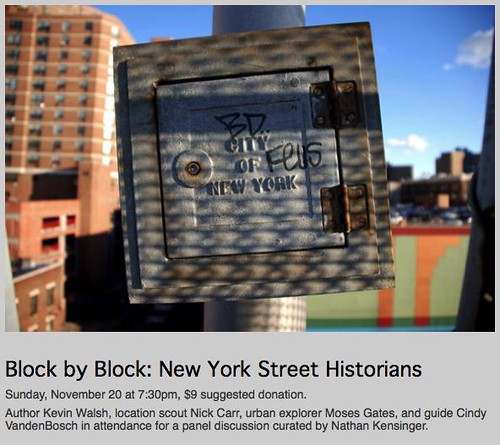
Block By Block: New York Street Historians


On Sunday, November 20th, 2011, I curated an event titled "Block By Block: New York Street Historians" at UnionDocs, the documentary collaborative in Williamsburg, Brooklyn. The event was a panel discussion with several "street historians" who are creatively exploring and documenting the city - author Kevin Walsh of Forgotten New York, location scout Nick Carr of Scouting New York, urban explorer Moses Gates of All City New York, and tour guide Cindy VandenBosch of Urban Oyster. "Block by Block" was featured in the Wall Street Journal, Urban Omnibus, and the Brooklyn Paper, and in an article I wrote for PBS 13 WNET's website, MetroFocus. The event was part of a series of UnionDocs panels I am curating - the first, from April 2011, was "Down the Road: Modern New York Street Photographers." More information can be seen at the UnionDocs website.

The following is from my description of "Block By Block":

"In a city as vast as New York, there is always a story waiting to be told, a block waiting to be walked, a building with an unwritten history. Over the past decade, many New Yorkers have been creatively documenting the changing streets of the city on websites and blogs. Often, these modern day storytellers are not historians or authors by training. Their work is part of a tradition of “unofficial,” “informal,” “underground,” and “alternative” histories of New York City. However, after walking through the city block by block, a better title for their work could be “street history.”

The modern New York City street historian can be traced back to George G. Foster, a reporter who explored 1800′s New York as it grew from a town into a modern metropolis. His seminal work, “New York By Gas Light” (1850), is considered a groundbreaking example of urban non-fiction, and presented “the under-ground story – of life in New York,” with portraits of “the festivities of prostitution, the orgies of pauperism, the haunts of theft and murder, the scenes of drunkenness and beastly debauch.”

Foster’s candid explorations of New York’s streetscapes directly influenced the work of many writers in the 1900′s, including Joseph Mitchell – The New Yorker magazine’s “poet of the waterfront,” Herbert Asbury – a reporter who penned a series of “informal” New York histories including “The Gangs of New York,” and Meyer Berger – a Pulitzer Prize winning journalist and “incurable New Yorker” whose colorful New York portraits were published in several collections.

In the same era, several New York street historians physically embraced the challenge of exploring modern New York. For his magnum opus, “History in Asphalt” (1978), amateur historian John McNamara walked, biked or canoed every street in the Bronx, creating an exhaustive encyclopedia of street and place names. His peers include Commander Thomas J. Keane, who completed his walk of every street on Manhattan Island in 1954. Unfortunately, Keane did not keep a diary, but in the next century, Robert Jay Kaufman did, writing “Blockology: An Offbeat Walking Guide to Lower Manhattan” (2005), after walking the 1,544 blocks below 14th Street, a distance of about 300 miles.

Today’s panel brings together four active New York City street historians – a guide, an author, an urban explorer, and a location scout – who are tirelessly exploring the 21st century city, block by block, on their own unique paths - Nathan Kensinger, curator"

Announcing The Newtown Creek Armada


On November 8th, 2011, The North Brooklyn Public Art Coalition (nbART) announced the selection of its sixth public art project, The Newtown Creek Armada, an interactive installation in which a model boat pond will be created on the Newtown Creek, one of America's most polluted waterways. The Newtown Creek Armada is a collaboration between myself and two other Brooklyn artists - Laura Chipley and Sarah Nelson Wright - whose work also explores industry, ecology, and change in urban spaces. The project was created in response to nbECO 2012, an open call seeking environmentally and sustainability conscious art installations.

The Newtown Creek Armada will be launched in Fall 2012, when visitors will be invited to pilot a fleet of artist-created, miniature, radio-controlled boats along the Newtown Creek's surface, while at the same time documenting the world hidden beneath the water. Each boat in The Armada will be equipped with a waterproof camera, allowing participants to record a unique voyage on and under the creek. Video from these underwater explorations will be on view at the creek, giving visitors a chance to virtually immerse themselves in the toxic waters of this Superfund site. In 2013, the archive of voyages from The Armada will be presented in an immersive gallery installation.


The Newtown Creek has been a neglected toxic waste zone for more than a century, and has been described as "the bleeding edge of an environmental disaster, one of the largest oil spills in the world," by Mother Jones Magazine. I have been photographing the polluted banks of the Newtown Creek for several years, as part of my explorations of New York City's industrial edges. Photo essays on this website about aspects of life along the creek include Newtown Creek: Brooklyn Shores (2011), Secret Parties (2009), The Dutch Kills (2008) and Linden Hill Tracks (2007). In 2010, the Newtown Creek was declared a Superfund site by the Environmental Protection Agency, and a massive cleanup effort is now underway. The Newtown Creek Armada will engage the long history of the creek while inviting the public to explore the potential of its polluted waters.

For more information on The Newtown Creek Armada, please visit the project's website: www.newtowncreekarmada.org