Block By Block: New York Street Historians


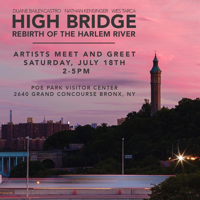
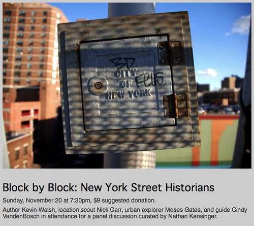
On Sunday, November 20th, 2011, I curated an event titled "Block By Block: New York Street Historians" at UnionDocs, the documentary collaborative in Williamsburg, Brooklyn. The event was a panel discussion with several "street historians" who are creatively exploring and documenting the city - author Kevin Walsh of Forgotten New York, location scout Nick Carr of Scouting New York, urban explorer Moses Gates of All City New York, and tour guide Cindy VandenBosch of Urban Oyster. "Block by Block" was featured in the Wall Street Journal, Urban Omnibus, and the Brooklyn Paper, and in an article I wrote for PBS 13 WNET's website, MetroFocus. The event was part of a series of UnionDocs panels I am curating - the first, from April 2011, was "Down the Road: Modern New York Street Photographers." More information can be seen at the UnionDocs website.

The following is from my description of "Block By Block":

"In a city as vast as New York, there is always a story waiting to be told, a block waiting to be walked, a building with an unwritten history. Over the past decade, many New Yorkers have been creatively documenting the changing streets of the city on websites and blogs. Often, these modern day storytellers are not historians or authors by training. Their work is part of a tradition of “unofficial,” “informal,” “underground,” and “alternative” histories of New York City. However, after walking through the city block by block, a better title for their work could be “street history.”
The modern New York City street historian can be traced back to George G. Foster, a reporter who explored 1800′s New York as it grew from a town into a modern metropolis. His seminal work, “New York By Gas Light” (1850), is considered a groundbreaking example of urban non-fiction, and presented “the under-ground story – of life in New York,” with portraits of “the festivities of prostitution, the orgies of pauperism, the haunts of theft and murder, the scenes of drunkenness and beastly debauch.”

Foster’s candid explorations of New York’s streetscapes directly influenced the work of many writers in the 1900′s, including Joseph Mitchell – The New Yorker magazine’s “poet of the waterfront,” Herbert Asbury – a reporter who penned a series of “informal” New York histories including “The Gangs of New York,” and Meyer Berger – a Pulitzer Prize winning journalist and “incurable New Yorker” whose colorful New York portraits were published in several collections.

In the same era, several New York street historians physically embraced the challenge of exploring modern New York. For his magnum opus, “History in Asphalt” (1978), amateur historian John McNamara walked, biked or canoed every street in the Bronx, creating an exhaustive encyclopedia of street and place names. His peers include Commander Thomas J. Keane, who completed his walk of every street on Manhattan Island in 1954. Unfortunately, Keane did not keep a diary, but in the next century, Robert Jay Kaufman did, writing “Blockology: An Offbeat Walking Guide to Lower Manhattan” (2005), after walking the 1,544 blocks below 14th Street, a distance of about 300 miles.

Today’s panel brings together four active New York City street historians – a guide, an author, an urban explorer, and a location scout – who are tirelessly exploring the 21st century city, block by block, on their own unique paths - Nathan Kensinger, curator"

Announcing The Newtown Creek Armada


On November 8th, 2011, The North Brooklyn Public Art Coalition (nbART) announced the selection of its sixth public art project, The Newtown Creek Armada, an interactive installation in which a model boat pond will be created on the Newtown Creek, one of America's most polluted waterways. The Newtown Creek Armada is a collaboration between myself and two other Brooklyn artists - Laura Chipley and Sarah Nelson Wright - whose work also explores industry, ecology, and change in urban spaces. The project was created in response to nbECO 2012, an open call seeking environmentally and sustainability conscious art installations.

The Newtown Creek Armada will be launched in Fall 2012, when visitors will be invited to pilot a fleet of artist-created, miniature, radio-controlled boats along the Newtown Creek's surface, while at the same time documenting the world hidden beneath the water. Each boat in The Armada will be equipped with a waterproof camera, allowing participants to record a unique voyage on and under the creek. Video from these underwater explorations will be on view at the creek, giving visitors a chance to virtually immerse themselves in the toxic waters of this Superfund site. In 2013, the archive of voyages from The Armada will be presented in an immersive gallery installation.


The Newtown Creek has been a neglected toxic waste zone for more than a century, and has been described as "the bleeding edge of an environmental disaster, one of the largest oil spills in the world," by Mother Jones Magazine. I have been photographing the polluted banks of the Newtown Creek for several years, as part of my explorations of New York City's industrial edges. Photo essays on this website about aspects of life along the creek include Newtown Creek: Brooklyn Shores (2011), Secret Parties (2009), The Dutch Kills (2008) and Linden Hill Tracks (2007). In 2010, the Newtown Creek was declared a Superfund site by the Environmental Protection Agency, and a massive cleanup effort is now underway. The Newtown Creek Armada will engage the long history of the creek while inviting the public to explore the potential of its polluted waters.

For more information on The Newtown Creek Armada, please visit the project's website: www.newtowncreekarmada.org

Gowanus Canal: Toxic Playground


October 31st, 2011 - This photo essay is excerpted from a lecture & slideshow I presented at Cabinet Space on October 8th, 2011 titled "Gowanus Canal: Toxic Playground," which was part of Gowanderlust, my nighttime walking tour of the Gowanus Canal organized by Cinebeasts. For a description and photos from Gowanderlust, read the Urban Omnibus writeup.

For the past several decades, the Gowanus Canal has been a center of unrestricted creativity in Brooklyn. With seemingly few rules or regulations, the canal area became a source of inspiration to numerous artists, filmmakers and photographers. Bohemian communities developed on its waters, including a houseboat armada and the now-defunct Batcave. Its empty lots, once described as "Brooklyn's biggest toxic playground" by Robert Guskind, were taken over by graffiti artists, sculptors, and homeless camps. Arts groups and gallery spaces, including Rooftop Films and Issue Project Room, found homes in its industrial buildings. Creative projects like the Dumpster Pools were installed on its banks, while community groups like the Gowanus Dredgers organized access to its waters.

However, the darker side of the canal's lawlessness includes more than a century of criminal dumping. As chronicled in Allison Prete's documentary "Lavender Lake: Brooklyn's Gowanus Canal" (1999), the canal has long been "an open sewer" for the surrounding communities, in the fecal sense and in other ways. The canal was completed in 1869, according to the Environmental Protection Agency, and industries along its shores have been poisoning its waters ever since. At one point, according to stories, the pollution was so bad that the canal was prone to spontaneous combustion. It was also a reputed Mafia dumping ground, with neighbors finding dead bodies in the water, sometimes tied to chairs. In 2010, the canal was Superfunded, with the EPA labelling it "one of the nation's most extensively contaminated water bodies."

Canoeing on the Gowanus Canal (2009)

For the past eight years, the Gowanus Canal was my backyard. I boated in its waters with an inflatable boat found in a trashcan, swam in the dumpster pools, went to parties on its houseboats, canoed with the Gowanus Dredgers, and explored the many abandoned buildings and empty lots on its shores. The Gowanus was an early inspiration for my photographs of New York's industrial waterfront, and I assisted many other filmmakers, journalists and photographers in their creative pursuits along the canal.

In the past few years, even with its Superfund designation, a surge of upscale hotels and venues has threatened to overwhelm the canal's established creative community. The lure of empty streets, open space, and a measure of lawlessness has drawn new crowds to the neighborhood, and to large warehouse venues like The Bell House, Littlefield, and the Brooklyn Boulders rock climbing gym, located in the old New York Daily News garage. At the same time, however, new creative projects have also appeared on the canal, offering a balance to the suddenly crowded streets. These include the hand-built birdhouses of the Canal Nest Colony and several guerrilla gardens that have sprung up on dead end streets. As the cleanup of the Gowanus Canal continues over the coming decades, it will hopefully not erase the unique balance of industrial, artistic, and creative uses that continue to thrive in the area.

---
For more photo essays about the Gowanus Canal, please visit The Whole Foods Lot (2010), The Batcave Revisited (2010) and the Hamilton Avenue Marine Transfer Station (2009).


Bran (2009)


Toxic Playground (2009)


Silos and Graffiti (2009)


Rubble Sculpture (2009)


Abadi Warehouses (2009)


Graffiti Blocks (2009)


Whole Foods Lot (2009)


You Go Girl (2009)


Filmmaker Digging (2009)


The Batcave Revisited (2010)


Long Gone (2010)


Needle Supply (2010)


Dumpster Pools (2009)


Dumpster Diving (2009)

Doomsday Symposium: The Post-Apocalyptic New York Landscape

October 19, 2011 -

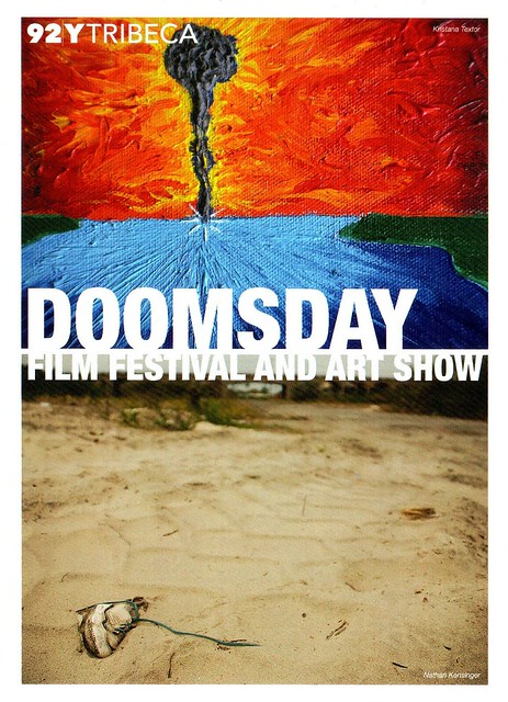
From October 21st 2011 to January 2012, a selection of my photographs will be exhibited at the 92Y Tribeca. The exhibit, part of the 3rd annual Doomsday Film Festival and Symposium, "brings together a wide variety of artists who have created work inspired by the idea of an Apocalypse." My photographs will explore the post-apocalyptic landscape, with images of devastation from across New York City.

The selected photographs capture the ruins of a once thriving industrial empire, the remains of neighborhoods that have been destroyed and wiped off the map, abandoned military bases and civic structures, toxic environmental wastelands, and the unstoppable return of nature to desolate areas where humans once lived. They include the photograph featured above, from the South Edgemere Wasteland, a New York City neighborhood which was destroyed over 35 years ago during an economic and social crisis, and which has since become a beachfront wilderness populated by homeless encampments and marauding wild dog packs.

The exhibit will open on Friday, October 21st with a reception from 6-8pm. For more information, please visit the 92Y Tribeca.

Child's Shoe - The South Edgemere Wasteland (2010)

Bring To Light: The Forgotten City


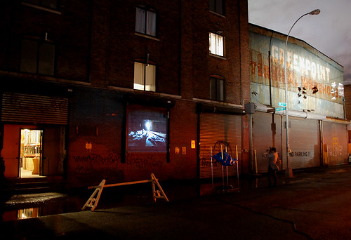
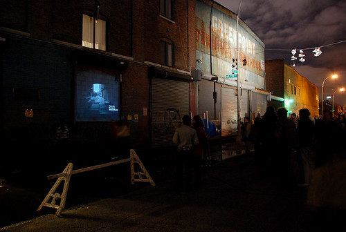
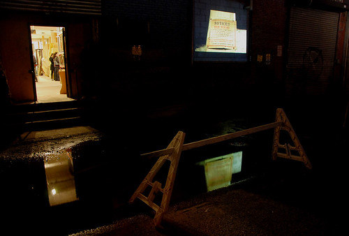
On October 1st 2011, my photographs from inside the Greenpoint Terminal Market were projected onto the exterior of this warehouse complex in a site-specific installation titled "The Forgotten City." The piece took viewers through the hidden rooms and passages of these warehouses with a series of photographs taken between 2007 and 2011. The piece detailed the history of these buildings, which date back to 1890, and included stories of riots, explosions, fires and squatters. "The Forgotten City" was inspired by my original photo essay, "The Greenpoint Terminal Market Revisited," which was published on this website in November 2010.

This installation was a part of Bring To Light, an outdoor nighttime art festival of light-based video, sculpture and installations on the Greenpoint waterfront. Bring To Light included over 50 artists from around the world, "some of the established auteurs of this artistic genre... and a long list of emerging talent," according to Urban Omnibus. "The Omnibus team, proud civic partner of the event, is particularly excited to check out... the industrial photography of Nathan Kensinger."

Brooklyn Based wrote of the event "photographer Nathan Kensinger has a... interesting project planned for Bring To Light. He’s been taking photos along Greenpoint’s waterfront for years, and will be projecting images that he’s captured of the inside of the Greenpoint Terminal Market onto the side of one of its buildings tomorrow. 'The photographs were taken over the past five years, and will be presented along with the story of the buildings, which date back to 1890,' Kensinger wrote... 'They have a long, dark history: a century ago, a thousand workers rioted in the streets in front of the Greenpoint Terminal Market, in the same streets where Bring To Light will take place.'"

For more information, visit Bring To Light's website: www.bringtolightnyc.org. The following are several photographs documenting the installation.


"The Forgotten City"
at Bring to Light (2011)


"The Forgotten City"
at Bring to Light (2011)


"The Forgotten City"
at Bring to Light (2011)


"The Forgotten City"
at Bring to Light (2011)

Governors Island: Manhattan's Ghost Town


September 21, 2011 -

Governors Island is a 172-acre ghost town on the southern shore of Manhattan. Covered in ruins, the island houses an impressive collection of abandoned structures, with empty apartment towers, homes, schools, churches, swimming pools and playgrounds. Half of the approximately 100 buildings on the island are in some state of decay, including a supermarket, auto body repair shop, movie theater and hospital. Many of the other buildings are controlled ruins, minimally cleaned up to allow limited public access. Walking through this deserted landscape is a surreal experience, especially when considering its close proximity to the bustling financial center of lower Manhattan.

After serving as a base for military operations for over 200 years, Governors Island was abandoned by the Coast Guard in 1996. The federal government sold most of the island to New York City for $1 in 2003. Today, Governors Island has come to resemble San Francisco's Alcatraz Island and Japan's Gunkanjima Island, with evocative off-limits ruins dominating the landscape while smaller sections are slowly reclaimed and opened to the public. Artists have been brought in to help colonize the wilderness, creating a variety of installations inside otherwise empty spaces. Often, they are appropriately post-apocalyptic - embalmed wildlife, metal skeletons, animal bones, zombie films. Despite these creative uses, many of the island's structures are slated for demolition, to make way for a public park. Some have been purposefully set ablaze by the fire department to "test new techniques."

These photographs were take between 2005 and 2011, after the island was opened to the public. They offer an update to a photo series from 2003-2004 titled "Governors Island: Photographs by Lisa Kereszi and Andrew Moore," a project commissioned by the Public Art Fund to document the deserted island before it was open to the public. Hundreds of thousands of people have visited Governors Island since it has been made accessible, but the ruins still remain.

---
For more photo essays from partially abandoned New York City islands, please visit The Encampment on Roosevelt Island (2007) and Ellis Island: South Side (2007).


Living Room (2005)


Rope Swing (2005)


Bulldozer Playground (2009)


Game Time (2009)


Bones (2009)


Fenced Off Homes (2009)


Fire Practice Tower (2011)


Coast Guard Bedroom (2011)


Empty Kitchen (2010)


Raccoon Island (2010)


Abandoned Classrooms (2008)


Blackboard (2008)


Dropped Ceiling (2008)


Hospital Kitchen (2011)


Box Office (2009)


Theater Lobby (2009)


Empty Theater (2009)


Church Interior (2009)


Hospital Lounge (2011)


Hospital Admissions (2011)


Staircase (2011)


Abandoned Hospital (2011)


Water's Edge (2010)

The Demolition of Manhattanville


August 31, 2011 -

Not long ago, the streets of Manhattanville were lined with small businesses. Gas stations, auto body shops, parking garages and storage buildings stood alongside popular restaurants, creating a unique mixed-use neighborhood. Today, that neighborhood has largely been demolished. Businesses have been shuttered. Warehouses have been reduced to cracked bricks. In total, seventeen acres in the heart of this historic industrial valley will be destroyed and Manhattanville will be a construction site for the next two decades, as Columbia University completes its plan to build a $7 billion campus extension.

This past December, the state of New York won the final round in a six year battle against the last private property owners inside Columbia University's project footprint. The owners had been fighting against the state's decision to use eminent domain to seize their property and hand it over to the university. The battle went all the way to the United States Supreme Court, which ultimately refused to hear the property owners' appeal. "In all likelihood... the battle is over," the NY Times wrote after the decision, and since then the demolition of Manhattanville has proceeded quickly.

Barricade Road


Sinkhole and Pigeon

The blocks condemned by the university's plan already feel desolate and abandoned. Huge vacant lots are filled with dirt, debris and heavy equipment. Emptied buildings are marked by the symbols of planned demolition. A sinkhole idles in the middle of an unused road, clogged with trash. Sidewalks are inaccessible, streets lined with barricades. "The Manhattanville expansion will, by Columbia’s own estimates, displace 5,000 people," according to the Columbia Spectator, creating a temporary ghost town while the project is underway. Residents who remain in the area complain that a "rat epidemic" has been unleashed by construction activity, according to the Columbia Spectator, while others fear the swirling clouds of demolition dust will cause respiratory illness, according to DNAinfo, leading the university to buy air conditioners for at least one apartment tower.

A century ago, these empty streets teemed with horses. Manhattanville's long industrial history includes thriving dairy factories with stables that sent out "wagons to drop off thousands of bottles every morning to individual customers," according to the NY Times, alongside "factories producing lumber, paint, beer, dye and other materials." Columbia has already demolished at least one historic stable, and Manhattanville's industrial heritage will soon be consigned to the past. The majority of street traffic today is from yellow cabs refueling at the neighborhood's two remaining gas stations. They are scheduled to be torn down too.

If all goes according to plan, the Manhattanville campus will be completed by 2033. However, "of the 17 planned buildings on campus, the specific uses of only six have been determined," according to the Columbia Spectator, and in the meantime, the failing economy has led the Village Voice to ask "will NYC's college building boom bubble pop?" For now, Manhattanville's empty lots and demolished businesses wait for their promised transformation.

---
For more photo essays on neighborhoods endangered by eminent domain, please visit The Bloomberg Era, Part Two (2010), Manhattanville: Phase One (2008), The Iron Triangle (2008), and The Atlantic Yards (2007).


Dinosaur Bar-B-Que Demolition


Crushed Warehouse and Diner


Demolition Debris


Viaduct and Empty Lot


Jesus is Good


Crossed Cranes


Manhattanville Houses and Cranes


Cleaning Up


Condemned Home and Dumpster


Condemned MTA Warehouse


Idle Garage


Gate N


Brick Field